This is a review of the RockStar Gravel Route, which I rode with two other people in late October. We took four days and camped three nights while covering a total of 267.25 miles and 26,503 feet of climbing during the entire trip. The Rockstar gravel route itself is somewhat shorter, but our trip included getting lost and a few side trips.
The RockStar Gravel Route is one of three RockStar routes that go between Harrisonburg and Roanoke, VA. The nicknames of each city, Rocktown and the Star City, respectively, give the routes their name. Rob Issem, currently the city of Roanoke’s Complete Streets and Vision Zero Coordinator, helped create each route and they aim to provide an epic experience showcasing great places to ride and see.
I’m going to try to keep this review high–level and may supplement with some more in-depth discussions of the route and the gear that I used. Overall, the RockStar Gravel Route was very difficult, but a fun and unique challenge worth doing.
If you are a confident cyclist who has recently successfully completed a longer day ride of 100 miles or more then you should be able to do the RockStar Gravel Route without much additional training. If any day of the RockStar Gravel Route would be your longest-ever ride, or you are not comfortable on a variety of gravel and off-road trails, or you have not camped much then I highly encourage training for distance, confidence, and camping comfortably. I was probably a little undertrained, having done a 100 mile bike ride in April before training for a 10 mile run in August and then mostly not training consistently outside of gravel rides between 30-50 miles on probably 60% of the weekends between August and the trip in late October.
Carvin’s Cove
Lunch break after Covington
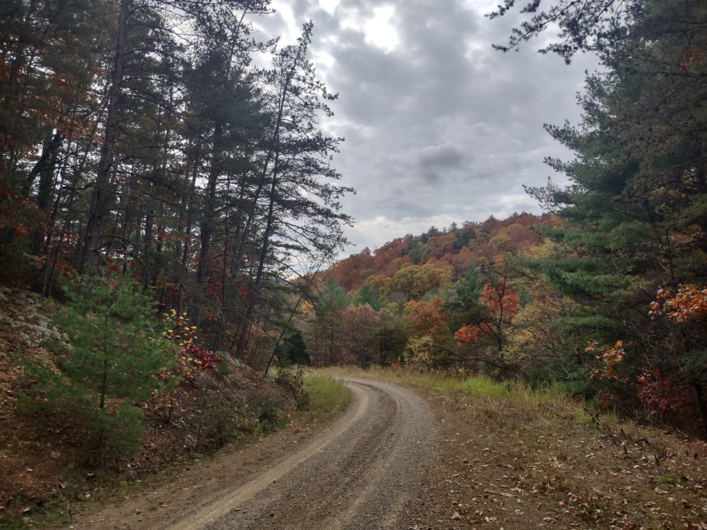
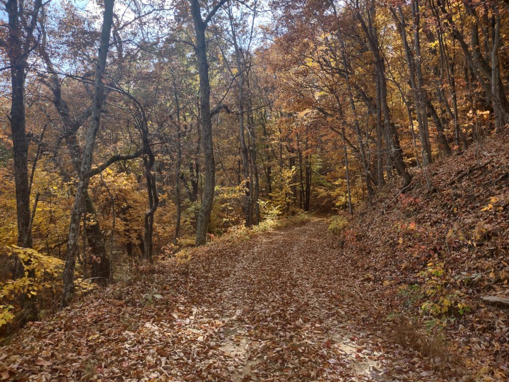
Miles of forest road double track

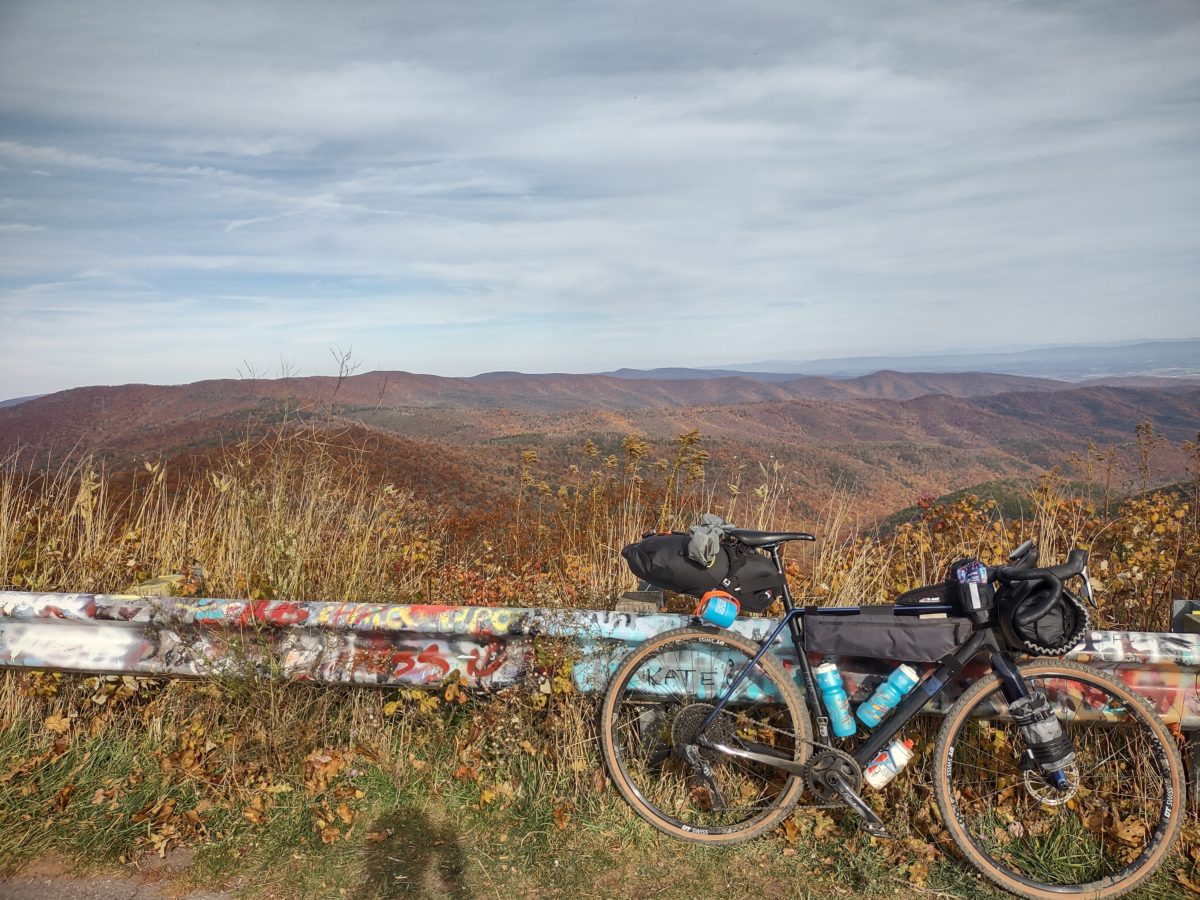
Top of Reddish Knob
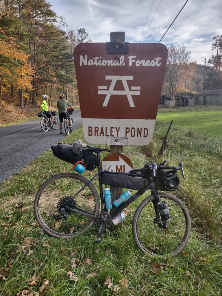
Pulling into Braley Pond
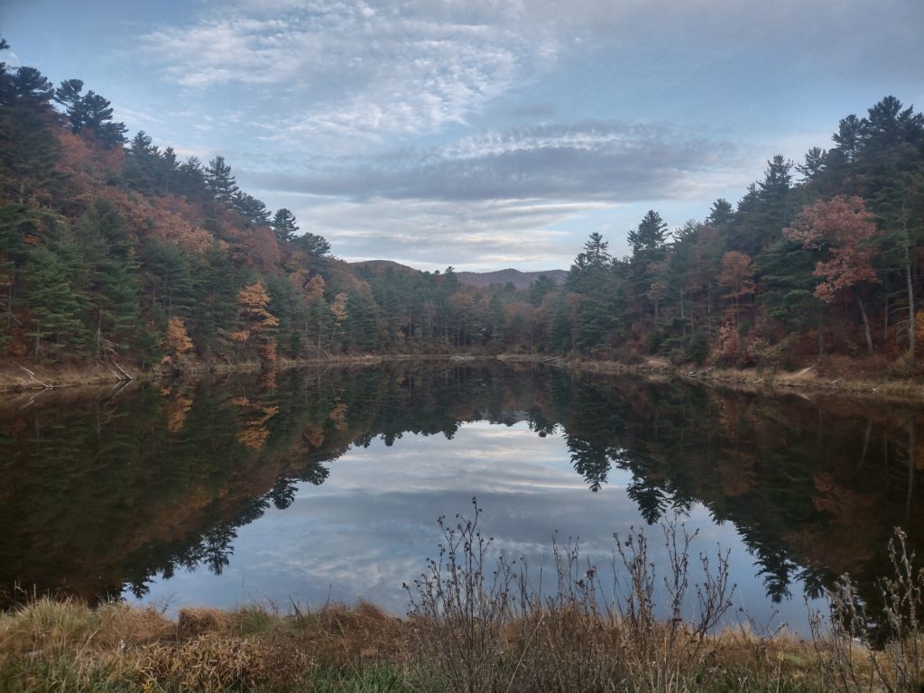
Braley Pond in the morning
The RockStar Gravel Route
Good: Varied. Surprising. Beautiful and adventurous. Progressive in the sense of getting easier (relatively) each day. Camping was easy and it was cool to meet friends at Douthat.
Bad: Big difficulty spike on the first day. Section below Flagpole Knob was just not rideable for me. Limited water at times.
Ugly: Virginia DOT needs to invest in better shoulders on several paved sections. Drivers need to chill out and wait to pass.
Day One: The hardest day. Water was a problem. Reddish Knob and gravel just before camp were highlights. Mountain View General Store and Braley Pond are both excellent.
- Strava: Before and After Lunch, to the General Store
- Videos: Start and Top of Reddish Knob
Day Two: Lots of forest service road double track. Some single track. All kinds of gravel. Long day with repetitive gravel climbs. Got lost, which sucked. Camping at Douthat was really nice.
- Strava: Getting Lost to Douthat
- Videos: Crushing Gravel on Cowpath Road and Lost near Douthat
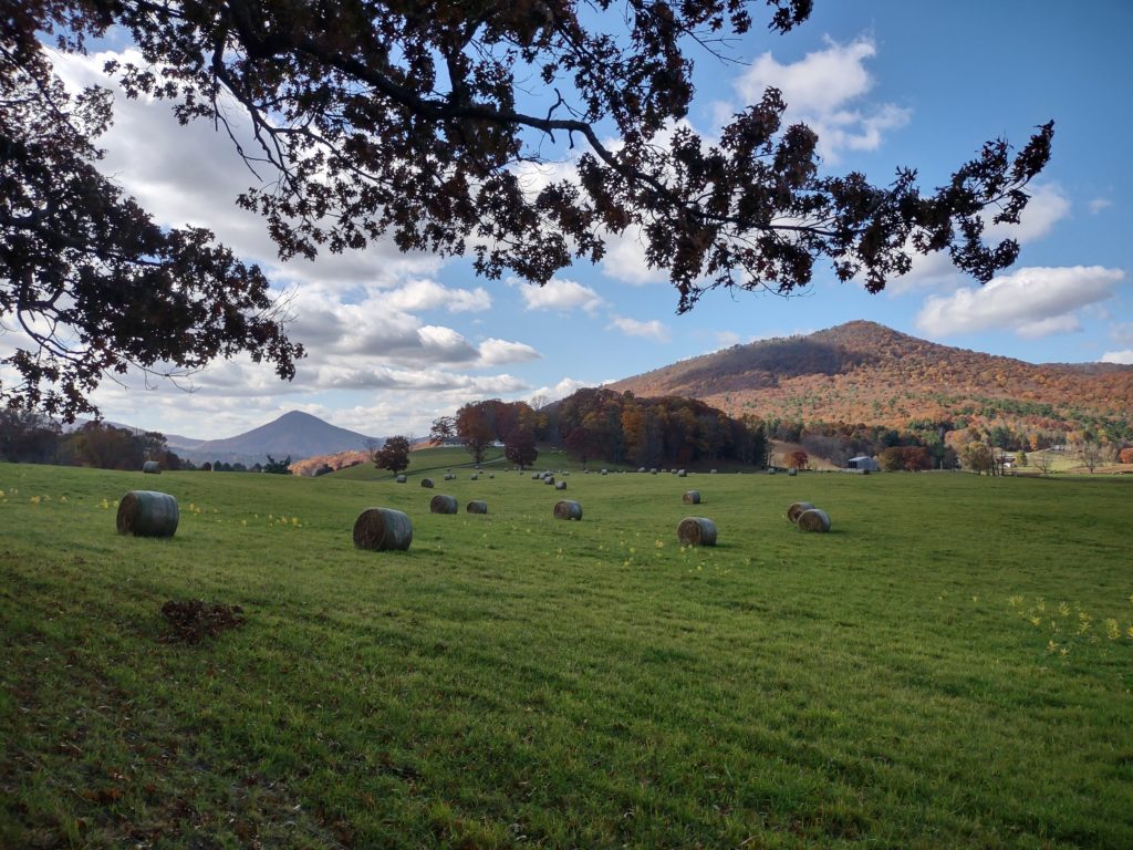
Day Three: More road riding. Riding through towns, climbing, and descents. Some river crossings and more gravel. Worst camping.
- Strava: Varied day with road descents
- Videos: High Valley near Covington and Grove Hill Road Descent
Day Four: More road riding. More urban. Carvins Cove has a big forest road climb and the Rockstar route shows off and meanders around Roanoke. Texas Tavern is unique, for me it was a crowded early dinner crowd and pleasant conversation for a short celebratory chili dog and coke.
- Strava: Carvins Cove and Home
- Video: Carvin’s Cove
Gear
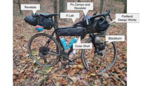
- Bikepacking bags: My Portland Design Works Gear Belly front roll was rock solid. My Outer Shell frame bag was great but I prefer the zipper on my old Revelate frame bag. My Revelate Spinelock 16L seat bag was stable and I liked the pin system. My Revelate and Po Campo handlebar feed bags were very useful and disappeared while riding. My XLab Stealth Pocket 200 XP is great for easy access.
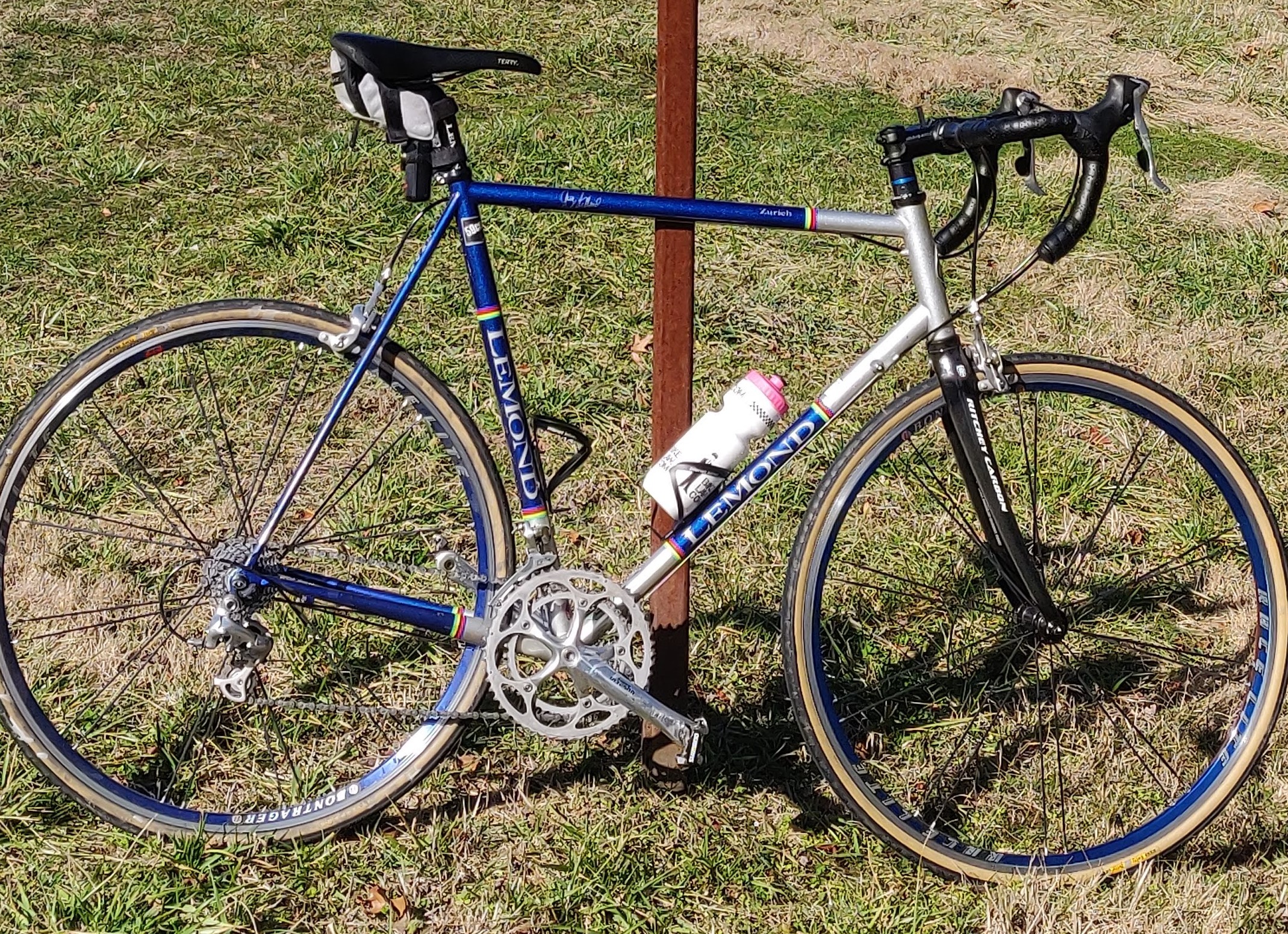
- Gravel bike: My Lauf Anywhere was the only rigid gravel bike on the trip and held up very well. Lots of mounts that I could have more fully utilized. Stable on descents and comfortable with the bikepacking load.
- Tires: Using WTB Raddlers in 700×38 front and rear I was the only rider to not get a flat. Tires were good on and off road, even on some single track.
- GPS: Basic Garmin 520 had the battery life to go all day. Recharged every night. I should have taken the time to create daily gps files.
- Tent and sleep system: North Face one person tent, REI inflatable sleeping pad, Cocoon drymax sheet, Western Mountaineering sleeping bag, Nemo inflatable pillow. Tent was bulky and basic, everything else was great.
- Camp food: Jetboil worked very well. Trailtopia Chili Mac was great and Curry Ramen was okay. Trailtopia oatmeal was really good.
- Clothes: Did two days in road kit and two days in mountain bike kit, both worked well. Adidas Velosamba shoes worked well for hike-a–bike, but got numb on long days. Change of sleep clothes and socks were a great luxury.
I think that’s everything to review. If you are ready for a challenge, then the Rockstar gravel route may be right for you. It is an adventure, with clearly intentional routing to embrace rockstar features such as Reddish Knob, Roaring Run Furnace, and the Roanoke Star.