The City of Roanoke was awarded a $480,000 Safe Streets and Roads for All grant from the United States Department of Transportation. With a 20% match, the city will have $600,000 to create an Action Plan to dramatically reduce traffic deaths in the city. The counties of Roanoke and Botetourt also received a grant.
The Safe Streets for All Grant is an incredible opportunity for the city to create a plan that will address the dangers faced by people biking, walking, driving, and taking transit. Included in the grant are dedicated dollars for collaboration with Virginia Tech, community engagement, and data-driven examinations of why people are killed and seriously injured on Roanoke’s streets.
Released with the USDOT’s announcement was a cool data tool, and this blog post digs into what that data tool says about Roanoke.
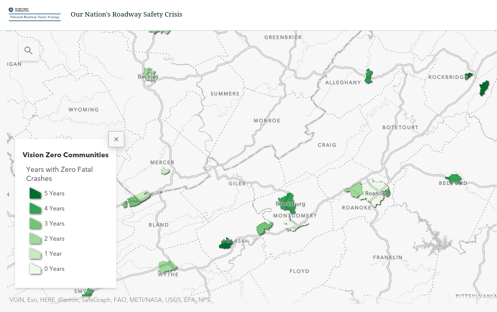
One way that USDOT presents data is by showing communities that have experienced zero fatal crashes. In the Roanoke region, several communities report zero traffic fatalities in recent years including Blacksburg and Vinton (4 years) and Salem (2 years). The city of Roanoke has zero years with zero traffic deaths according to USDOT.
Another way that USDOT presents data is by showing traffic deaths in historically disadvantaged communities. In the Roanoke region, there are two historically disadvantaged communities in the city of Roanoke and Franklin county is also a historically disadvantaged community.
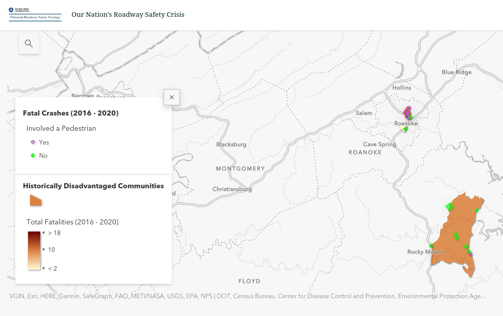
Zooming into historically disadvantaged communities in the city of Roanoke, we see that there is a tract that covers parts of the Old Southwest neighborhood and a tract that covers parts of NE Roanoke centered around Williamson Road. The tract in NE Roanoke has far more traffic fatalities than Old Southwest, and many more are people walking.
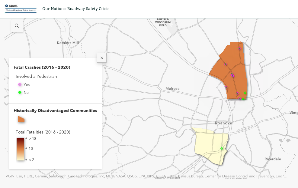
In NE Roanoke there are two obvious concentrations of fatalities:
Williamson Road
-
- At least 5 people were killed on Williamson between 2016 and 2020
- Williamson Road has a planning history and has been a source of competing letters to the editor and neighborhood groups
- Project Pipeline 2022: https://vaprojectpipeline.org/studies/salem/sa01-route-11—williamson-road.asp
- Major safety improvements would be from sidewalks, lighting, speed management, turn lane, and shorter crossing distances
Orange Ave
-
- At least 2 people were killed on Orange Ave between 2016 and 2020
- There’s a planning history
- Focus has been on operations (traffic flow), not safety. Pedestrian environment is challenging. Biking is discouraged. Significant potential foot traffic from Berglund Center, but no safe and easy crossings. Traffic is high speed and high volume. Crossing distances are long. Slip lanes are at intersections and merges from the highway.
The City of Roanoke’s Safe Street and Roads for All grant includes many activities, including:
- Engagement
- Speed Management
- Demonstration Projects
- Video Analytics and modeling
I think the USDOT tool does a good job of providing information useful to guide the implementation of Roanoke’s grant. It identified areas where the city already has ongoing plans. The grant can guide these plans into projects that create safer streets and listen to community traffic safety concerns to design for community needs.