A Better Brandon Avenue

Brandon Avenue has major issues. It is a road that is dangerous for people biking, walking, and driving. It is home to one of the most mindboggling intersections I’ve ever seen and two of the closest grocery stores to downtown Roanoke.

As I said in my statement to the City Council, Brandon Ave was identified as a priority corridor in the 2012 Bicycle Plan adopted by the Roanoke Regional Commission and for several pedestrian improvements in the 2015 Pedestrian Plan. As a corridor Brandon Ave from Main Street to Franklin Street sees multiple crashes per year, including at least one fatality each of the last two years and numerous serious injuries according to data from the Virginia Department of Transportation.

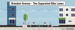
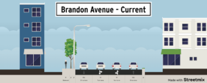
To improve Brandon Avenue, I think that the City needs to think radically. The City needs to consider a full reconfiguration from Brambleton to Franklin. Thinking radically in this case, for me, means going from four full travel lanes to two full travel lanes, one two-way left turn lane with periodic pedestrian refuges and marked crosswalks, and good bicycle facilities.

The current condition of Brandon Avenue between Main Street and Towers, and some options for a better configuration.

Going from four lanes to five lanes (with two of them just happening to be bike lanes), may feel radical because it is a major change, but it is not radical from a technical perspective. The Road Diet Informational Guide from the Federal Highway Administration (FHWA) includes lane reconfigurations like this for roads with up to 26,000 annual daily traffic (ADT). Brandon Avenue is around 21,000 ADT, well under the maximum reviewed in that guide and just on the border of roads considered “good candidates” by FHWA.

FHWA promotes lane reconfigurations like road diets because the two-way left turn lane helps maximize the efficiency of the roadway while reducing crashes between 19 and 47 percent and significantly improving bicycle and pedestrian safety. FHWA has endorsed the type lane reconfiguration I propose here through their Proven Safety Countermeasures and Every Day Counts programs. I have chosen to say that changing Brandon Avenue is radical because I believe it captures how the City of Roanoke may feel about it, not that these changes are new, innovative, or outside of the mainstream of traffic engineering.

Roanoke has already done a good job of identify places where lane reconfigurations can improve transportation. Of all Virginia localities surveyed by the Virginia Department of Transportation, it was the third locality in terms of number of lane reconfigurations reported. While Brandon Avenue would be the biggest lane configuration project yet, the city has received positive feedback on other similar projects and not a single similar project in Virginia has had most of its feedback be negative.

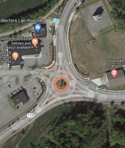
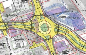
One of the major upsides of being radical is that the needs of the intersection at Brandon and Main might be altered so that it can be converted into a single lane roundabout – fixing one of the worst intersections in Roanoke. Or the intersection may otherwise be simplified.
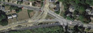
Brandon Ave and Main Intersection

Brandon Ave and Main Intersection

Without major changes Brandon Avenue will continue to be a road that dangerous for all of its users and that creates a barrier for most people biking and walking in Roanoke. It may feel radical to change it, but the alternative is a choice to accept crashes, accept traffic, and accept that things cannot improve.
I gave this statement to City Council on May 18th, 2020. Since this statement all sections of the Roanoke Greenway system are open. As of July, no announcement has been made about any action on Brandon Avenue. Tragically, one of the two people hit while walking across Brandon Avenue on May 15th has passed away. MacKenzie Beyers was 18 years old and had recently graduated from Botetourt High School. There have been at least two other pedestrians hit on Brandon Ave who suffered incapacitating injuries since 2013 according to data from the Virginia Department of Transportation.

———

Thank you Mayor and members of the City Council for hearing me today. I want to thank the City of Roanoke for listening to the many people who advocated for the reopening of the Greenway system. I hope that the phased reopening of the Lick Run Greenway, Garden City Greenway, and Tinker Creek Greenway was successful and without incidents of dangerous crowding over the weekend, and that people continue to be responsible as the Roanoke River Greenway reopens today.

Roanoke’s Greenway system is incredibly important because it is a place that is consistently safe and available for biking, walking, and other physical activity. Last Friday, unfortunately, we were reminded of how dangerous Roanoke’s roads and sidewalks can be for people outside of cars. The same day that people protested the sentence of the driver who hit Linda Pierson and left the scene, there was a person hit on Orange Avenue and two people hit on Brandon Avenue. These events highlight the dangers that the people of Roanoke face due to streets that prioritize cars and speed.

While there are many places that Roanoke can improve the safety of people who bike and walk, I’d like to talk about Brandon Avenue today. Brandon Ave was identified as a priority corridor in the 2012 Bicycle Plan adopted by the Roanoke Regional Commission and for several pedestrian improvements in the 2015 Pedestrian Plan. As a corridor the area from Main Street to Franklin Street sees multiple crashes per year, including a fatality last year and numerous serious injuries according to data from the Virginia Department of Transportation. Brandon Avenue is currently scheduled to be repaved this summer, but repaving plans have not been made public.

At the very least, the City should take the opportunity of repaving to carefully consider the corridor and how it can be made safer. Repaving alone is unlikely to result in large safety improvements, but it can set up further improvements down the road. I believe that the City should conduct a road diet or multimodal study of the corridor and allow public comments on repaving so that we can begin to make this a safe corridor rather than one that presents a barrier for people biking and walking accessing the Towers Shopping Center and threatens the safety of all people who use it.

The City is currently going through its Comprehensive Plan process and asking itself what it will look like in 20 years. With the repaving of Brandon Avenue this summer it can take a step toward a safer, more multimodal future, as its Comprehensive Plan envisions, or perpetuate the dangerous design that caters to speeding cars. I hope that the City carefully considers the opportunity presented by repaving and takes every step possible to ensure that what happens this summer is a step toward Roanoke’s future.

Statement to City Council on Brandon Avenue

Dale Avenue could be a great bike boulevard

Dale Avenue is a street that is recommended for bicycling by Google, but not on the Roanoke Bike Plan. What Google realizes is that Dale Avenue is a low traffic street with limited cross traffic that provides a good alternative to more trafficked or more difficult streets like Tazewell, Bullitt, and Jameson. With a few changes, Dale Avenue could be a great bike boulevard and a great connection to improved streets at 9th and 13th, creating a solid network for bicycling in southwest Roanoke.

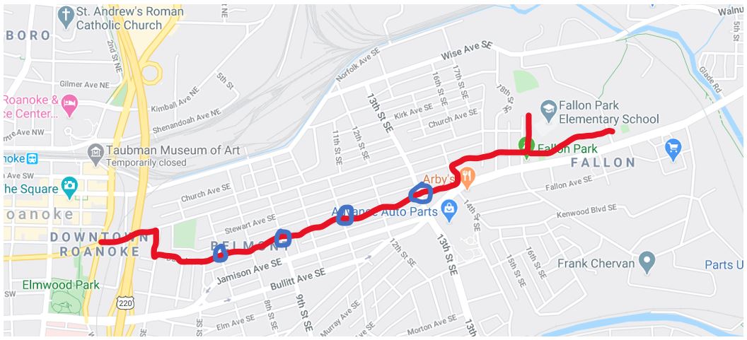
Dale Ave Project Sketch

Project sketch for all potential improvements on Dale Ave.

Here are some changes that could make Dale Avenue a street where it is clear that bicycling is a priority and that this is a preferred route for bicycling in southwest Roanoke:

The Easy ChangesSwitch stop signs on 7th and 11th streets

Currently there are stop signs at 7th and 11th street that stop traffic along Dale Avenue. To promote bicycle traffic flow, those stop signs could be switched so that they allow continuous travel on Dale Avenue. If there is a concern about speeding car traffic using Dale Avenue, then small traffic roundabouts could be added and with community art it could be a really cool project to bring attention to improvements in southwest Roanoke.

Bike Blvd Intersection Improvements

Dale Ave could be better with small roundabouts to complement a bike boulevard treatment.

An Easy Connection Make the Intersection of Dale and 9th Street more people-oriented

Dale Avenue crosses 9th Street north of Jamison where 9th street is a four lane road with a wide median. There is not much traffic on 9th street in this section and Dale Avenue would be improved as a bike boulevard if 9th street was only two lanes at this point, with parking and bike lanes. Parking is already allowed and there is a church nearby so parking at times may be significant. By marking parking lanes, bike lanes, and crosswalks at Dale Avenue this intersection will be significantly calmer and a much stronger connection in the southwest Roanoke bike network. Marking crosswalks may also help bicyclists feel comfortable crossing halfway if needed. If the parking demand is not super high, or the city wishes to further improve bicycle and pedestrian safety, then it would be great to create bump-outs with concrete, paint, or bollards at this intersection. It would also be interesting to use bike racks to provide some protection for a painted bump-out.

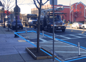
Example of painted bump-out with bollards

The intersection of Dale Ave and 9th Street could be improved with painted bump-outs and bollards to daylight the intersection.

A Bigger Ask Make the Intersection of Dale and 13th Street more people-oriented

A lot of what was just said about Dale Avenue and 9th Street could be said about Dale Avenue and 13th Street. 13th Street is higher traffic than 9th Street at its intersection with Dale Avenue. A great bike boulevard would require a median so that bicyclists can cross as few lanes as possible at a time. 13th Street has a larger project, and this would be an ideal time to make improvements at this intersection as well.

Thinking Bigger About ConnectionsConnect to Greenways using Dale Avenue

Dale Avenue has the possibility of making some great connections, but all would require some additional work.

  • Connect to Fallon Park and the Tinker Creek Greenway – Dale Avenue curves at 16th Street and then the bike boulevard can continue along Stewart Street. This has the benefit of avoiding the worst of hills. Where Stewart Street dead-ends at Fallon Park and Fallon Park Elementary School it would be great to have a path separate from the sidewalk to connect to the Greenway system in Fallon Park. A much bigger ask would be a bridge over Tinker Creek to avoid the rough road at Wise Avenue on the way to downtown Vinton.
  • Connect to the Mill Mountain Greenway – Tazewell Ave SE is four lanes for some reason from 4th Street SE to Williamson Road. This section sees ~5,000 vehicles per day and does not need 4 lanes. If the southern lane was taken away and repurposed into a two-way protected bike lane from the Mill Mountain Greenway at Elmwood Park to 4th Street then that would make a great connection and facilitate the use of Dale Avenue as a primary bike route, as well and provide a safe connection for people who use bikes to access the Rescue Mission. Repurposing that lane might take 8 parking spots, but there are many alternative places to park downtown. A two-way protected bike lane in front of the Roanoke Regional Partnership and Roanoke Outside would also be a great way to communicate that the city values biking.
Example of a 2-way protected bike lane

A two-way protected bike lane from the Mill Mountain Greenway to Fourth Street along Franklin/Tazewell would be a great connection from downtown to southeast.

Strava Heat Map of Campbell/Wise

13th Street has a plan – and it’s bad

One of the issues that people face while biking in Roanoke is moving between the different parts of the city and to surrounding communities. There are major barriers for anyone who wants to bike from southwest Roanoke to Northwest (mainly large and difficult intersections along Orange Ave), and the city of Roanoke is effectively segregated by infrastructure in many ways.

Currently it is fairly common and easy for people to bike from Downtown Roanoke to Downtown Vinton or vice versa. But, if a project currently planned for 13th street goes through as planned it will make this trip more difficult for people biking.

Strava Heat Map of Campbell/Wise

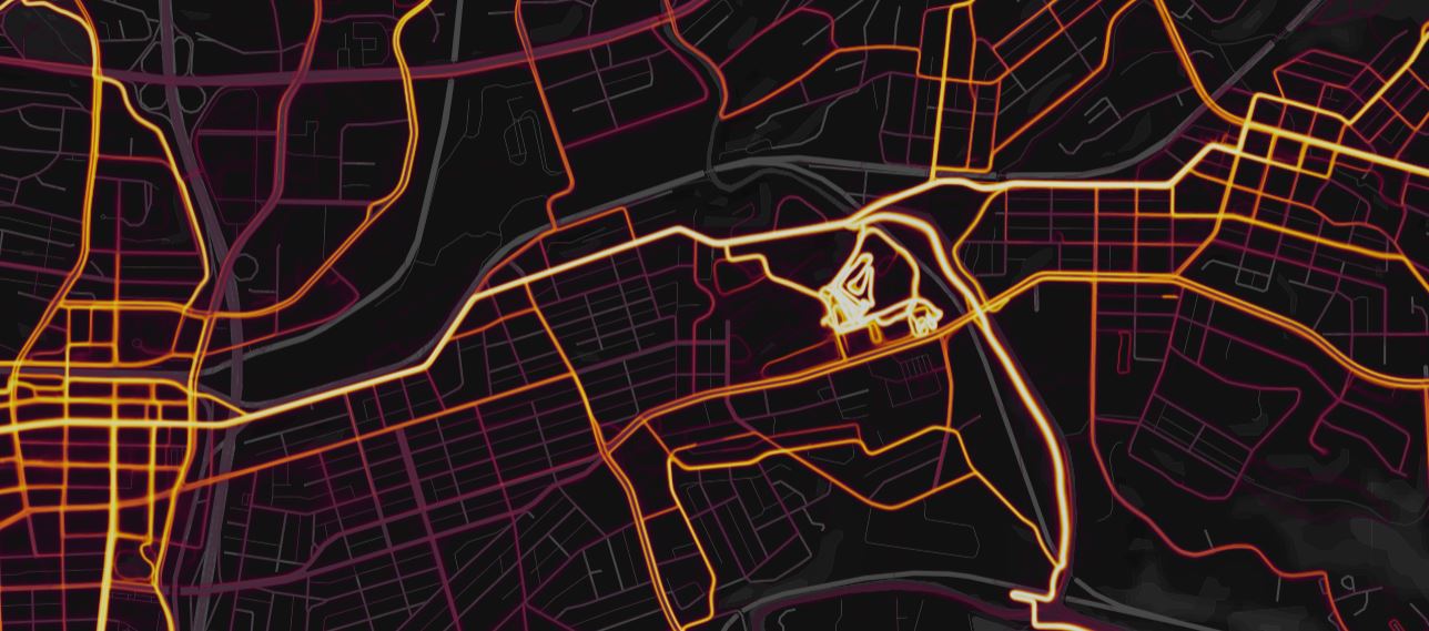
Campbell/Wise Ave is a popular bike route. This heatmap of Strava data shows its use.

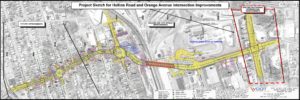
The biggest problem with the proposed project for 13th Street connecting to Hollins is a large roundabout at Wise Ave. Wise Ave is the bright east-west route in the Strava heat map above. It connect downtown Roanoke to downtown Vinton and both to the cyclocross course at Fallon Park , which hosts the annual GoCross race.

There are three major problems with the proposed roundabout designed for the intersection of 13th and Wise Ave:

  1. It is a multi-lane roundabout. While Wise is otherwise a two lane road, it will expand to four lanes at the roundabout. 13th Street going north will similarly go from two lanes to four at the roundabout. In both cases, a person riding through the roundabout will have to take the lane as drivers see more open space.
  2. It has slip lanes which encourage drivers to maintain speed through the roundabout. One potential benefit of roundabouts is that they slow drivers at intersections, reducing the chance of crashes that cause serious injury or death. By providing slip lanes for people turning right at the roundabout, the design encourages higher speeds and makes it more difficult for slower traffic, like people biking and walking, to navigate. There is an existing roundabout at Riverland Road and Bennington Street SE that has slip lanes and is similar in design. While the Roanoke River Greenway connects to the Garden City Greenway through this roundabout, the connection is not a path width and has several difficult angles.
  3. Roundabout design guidance in the United States says to not include bike lanes through a roundabout because traffic must cross the bike lanes. There is also no plan to provide a path or trail alternative or provide an alternate bike route. The larger project actually cuts off a low traffic bike route along Dale Avenue that shows up on Google maps, but not the Roanoke bike plan. This means all people who want to bike from Roanoke to Vinton or vice versa will have to take the lane through this high speed multi-lane roundabout with no bike lanes or other accommodations.

Overall, the 13th Street and Hollins Road project as proposed would make a significant bicycle route more difficult to navigate and less safe. The supposed upside is improved traffic flow, but the project proposal estimates that traffic will double from current levels. While Roanoke is a growing city, it is growing because of its outdoor appeal, not its lack of traffic congestion. The proposed project is estimated to cost $37 million and much of that cost is likely due to it being designed for a level of traffic that may never appear, much like 13th Street south of Jamison Avenue.

I sincerely hope that this project never comes to pass. When Roanoke applied for state funding through the Smartscale process it scored poorly. When it was scored in 2017, it was 38th out of 50 in the Salem VDOT district and was in the bottom half of all projects in the state.

This is a $37 million project with total costs that will likely be more than $60 million and will make it harder for people to bike between Roanoke and Vinton. While I am sure there are good reasons that it was developed, this is a bad project for people who bike and likely a waste of money for the taxpayers of Roanoke and Virginia.

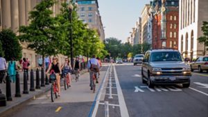
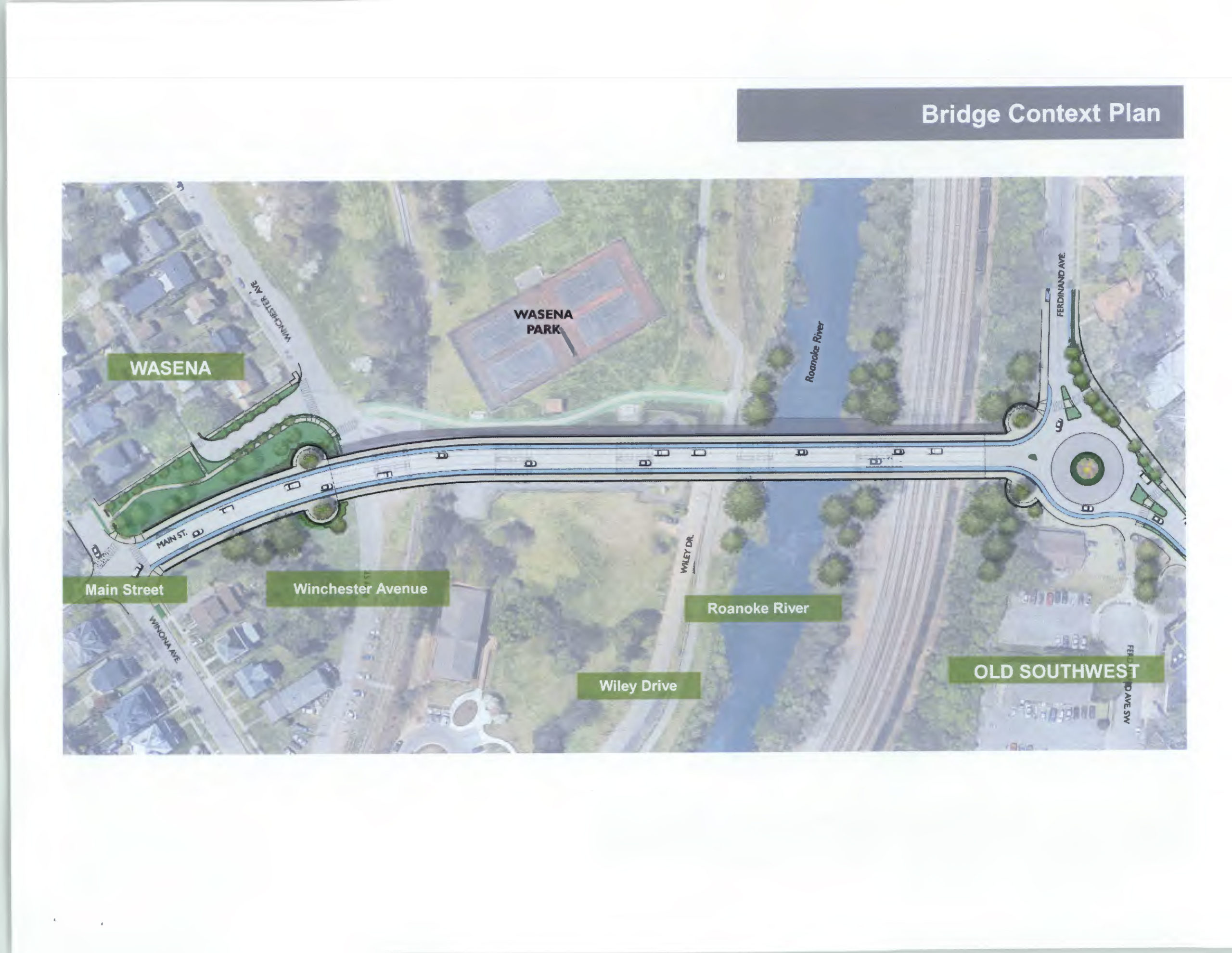
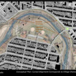
This is a picture of the new wasena bridge and its roundabout

A New, Better, Wasena Bridge

The current bridge connecting Old Southwest to Wasena was built in 1938 and is planned to be torn down and replaced starting in 2022. This new bridge is a once-in-a-lifetime opportunity to improve connections between the neighborhoods of Old Southwest and Wasena. It is also an opportunity to improve biking and walking connections.

The current bridge has fairly standard bike lanes, likely around four feet wide, with stormwater grates that are crosshatched so that they are unlikely to catch a bike tire. The raised sidewalks on either side are probably around 4 or 5 feet wide and there is no barrier between the sidewalks or bike lanes and the travel lanes. 

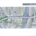
Replacing the bridge has been recognized by the City as a major project and it features prominently in on the Plan Roanoke website: https://planroanoke.org/wasena-bridge/. The new bridge has already been through several planning steps. The biggest feature that the public is likely to notice is the replacement of a traffic signal on the northeast side of the bridge with a traffic circle. As of February 2020, the most recent plans are available here: https://www.roanokeva.gov/AgendaCenter/ViewFile/Item/748?fileID=11621

At this stage, the bridge looks like a big improvement, particularly for people walking. There are several details that will make or break the experience for people biking:

  1. In the cross-section of the bridge shared in February 2020, the bridge is shown with 12 foot travel lanes and 5 foot bike lanes. This is likely to contribute to cars and trucks traveling faster than the signed 25 mph speed limit and 12 foot lanes are wider than recommended by the City of Roanoke’s Street Design Guidelines that says “The minimum travel lane width necessary should be used with 11 feet being the most common.”
  2. Many people who bike and walk are not comfortable using roundabout. Many people driving are not comfortable using roundabouts. Roundabouts are usually still a good thing because they slow down traffic and reduce high speed conflict zones. The angles entering and exiting the roundabout will be crucial to make vehicles slow down. If the angles facilitate people quickly driving through the roundabout without slowing, then it is likely to be unsafe.
  3. The relationship between approaches and exits to marked crosswalks and the transition of bike lanes into the roundabout will be crucial to making sure that all people are safe, seen, and understand where each person will go. Design guidance says that bike lanes should not continue through roundabouts and there is not much space in this area to do so anyway. Most people biking will experience this roundabout by merging into the full lane and traveling through the roundabout while occupying the full travel lane. This transition need to be clearly marked so that drivers expect it.
  4. Early drafts of the roundabout design identify potential greenway connections on either side of the roundabout. These potential greenway developments would be essentially expanded existing sidewalks along Ferdinand Ave SW and a new greenway right of way that connects from the roundabout to the dead-end of Highland Ave SW. These extensions are great ideas, but make it likely that at least some people biking will use the crosswalks and sidewalks to navigate the roundabout.

A Better Ninth Street SE

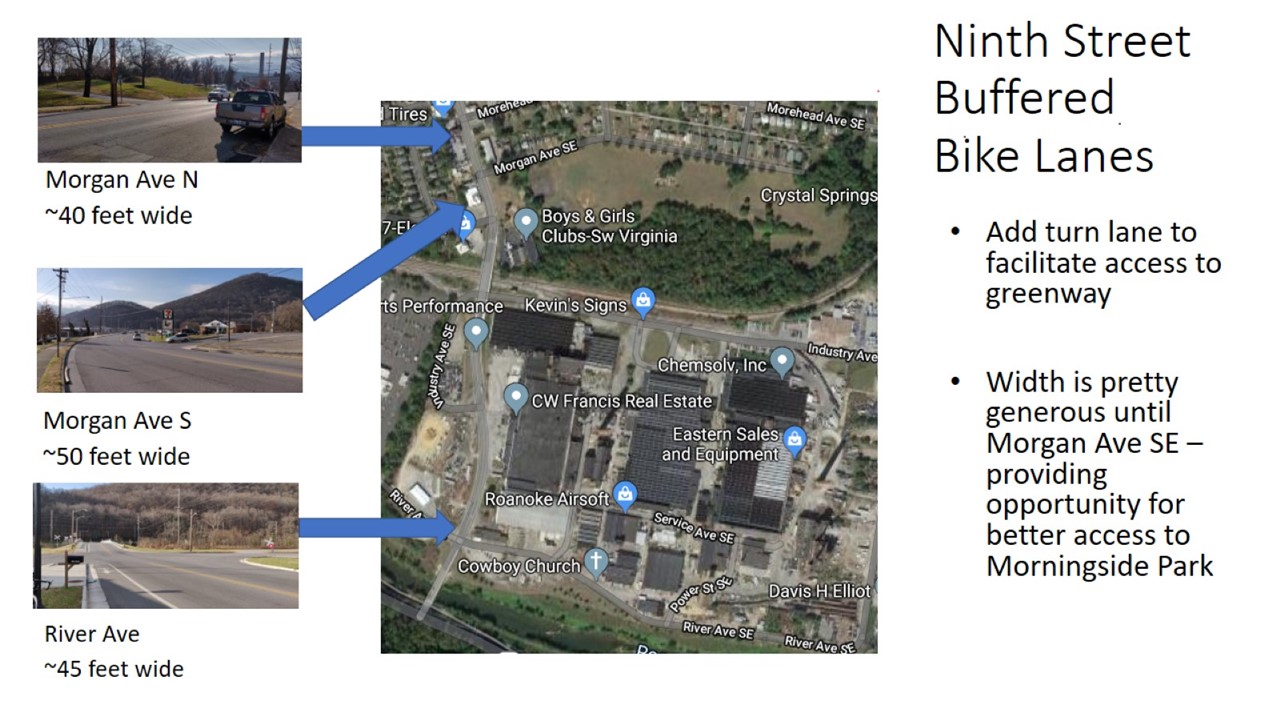
Ninth Street SE is a main street through the southeast of the City of Roanoke. At its northern end it is offset a half block so that it effectively terminates at Tazewell Ave SE. It is currently a four lane road in the northern part, expanding to five lanes at Jamison and Bullitt Avenues. South of Highland Ave SE it is a two lane road until it ends at Riverland Road SE.

Somewhat recently, Ninth Street SE was repaved from Riverland Road to the bridge that crosses over train tracks. Bike lanes extend from River Ave SE to the end of the bridge, which is just before the Boys & Girls Club. As of now, those bike lanes are the only bike infrastructure on Ninth Street and in the entirety of southeast Roanoke, other than the Roanoke River Greenway (and maybe the Garden City Greenway, but that feels separate).

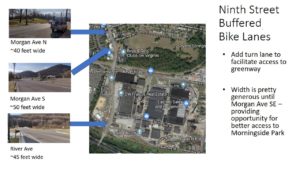
Ninth Street has a lot of potential to be better for bicycling. It is currently identified on the 2012 Roanoke Bicycle Plan as a vision project. While widths vary along the road, the two lane portions are generally between 40 and 50 feet wide, with limited parking demand, which provides a lot of potential space for bike lanes. There are many natural places that people might want to bike to that are on or adjacent to Ninth Street such as Morningside Park (which has mountain bike trails), Belmont Park and Belmont Library, and many businesses.


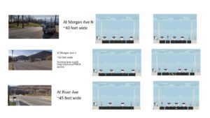
With the width between Morgan and River Ave there is the potential to try different improvements. In these mockups a center turn lane provides access to the Boys and Girls Club and businesses nearby, and near River Ave provides access to the Roanoke River Greenway and the Viscose factory site. Alternatively, the width could be used to create a two-way Greenway-like connection to Morningside Park so that more people can easily access the mountain bike trails there.