The current bridge connecting Old Southwest to Wasena was built in 1938 and is planned to be torn down and replaced starting in 2022. This new bridge is a once-in-a-lifetime opportunity to improve connections between the neighborhoods of Old Southwest and Wasena. It is also an opportunity to improve biking and walking connections.
The current bridge has fairly standard bike lanes, likely around four feet wide, with stormwater grates that are crosshatched so that they are unlikely to catch a bike tire. The raised sidewalks on either side are probably around 4 or 5 feet wide and there is no barrier between the sidewalks or bike lanes and the travel lanes.
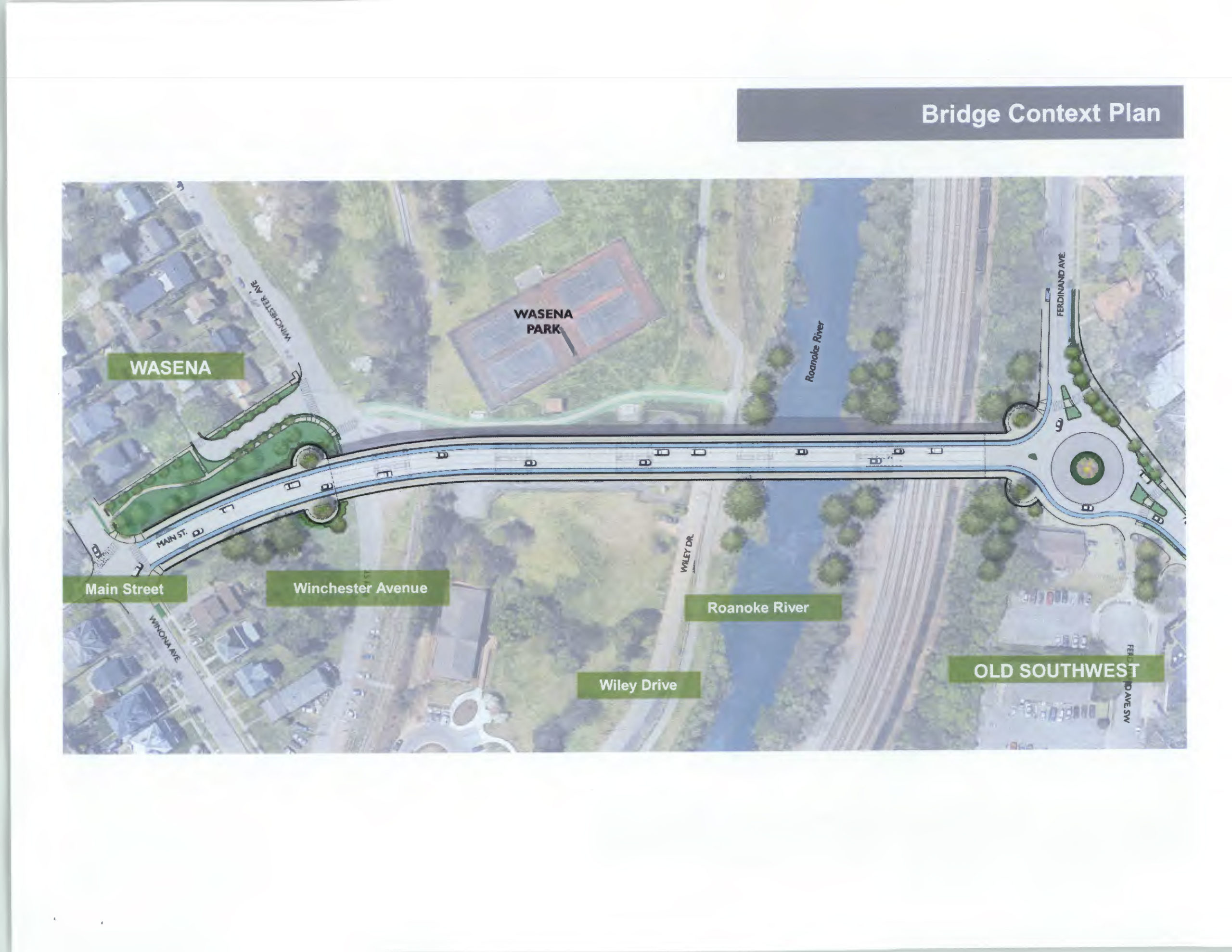
Replacing the bridge has been recognized by the City as a major project and it features prominently in on the Plan Roanoke website: https://planroanoke.org/wasena-bridge/. The new bridge has already been through several planning steps. The biggest feature that the public is likely to notice is the replacement of a traffic signal on the northeast side of the bridge with a traffic circle. As of February 2020, the most recent plans are available here: https://www.roanokeva.gov/AgendaCenter/ViewFile/Item/748?fileID=11621
At this stage, the bridge looks like a big improvement, particularly for people walking. There are several details that will make or break the experience for people biking:
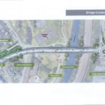
- In the cross-section of the bridge shared in February 2020, the bridge is shown with 12 foot travel lanes and 5 foot bike lanes. This is likely to contribute to cars and trucks traveling faster than the signed 25 mph speed limit and 12 foot lanes are wider than recommended by the City of Roanoke’s Street Design Guidelines that says “The minimum travel lane width necessary should be used with 11 feet being the most common.”
- Many people who bike and walk are not comfortable using roundabout. Many people driving are not comfortable using roundabouts. Roundabouts are usually still a good thing because they slow down traffic and reduce high speed conflict zones. The angles entering and exiting the roundabout will be crucial to make vehicles slow down. If the angles facilitate people quickly driving through the roundabout without slowing, then it is likely to be unsafe.
- The relationship between approaches and exits to marked crosswalks and the transition of bike lanes into the roundabout will be crucial to making sure that all people are safe, seen, and understand where each person will go. Design guidance says that bike lanes should not continue through roundabouts and there is not much space in this area to do so anyway. Most people biking will experience this roundabout by merging into the full lane and traveling through the roundabout while occupying the full travel lane. This transition need to be clearly marked so that drivers expect it.
- Early drafts of the roundabout design identify potential greenway connections on either side of the roundabout. These potential greenway developments would be essentially expanded existing sidewalks along Ferdinand Ave SW and a new greenway right of way that connects from the roundabout to the dead-end of Highland Ave SW. These extensions are great ideas, but make it likely that at least some people biking will use the crosswalks and sidewalks to navigate the roundabout.
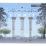
The Feb. 2020 draft show 12 foot travel lanes and unprotected bike lanes.
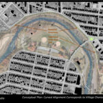
Early details of the new Wasena bridge imagine an extended greenway running through the roundabout
The new Wasena Bridge will feature a roundabout on its NW side.